Watch: Timelapse of storm cloud developing in Tennessee
Shelf-cloud moves across Tennessee
- Published
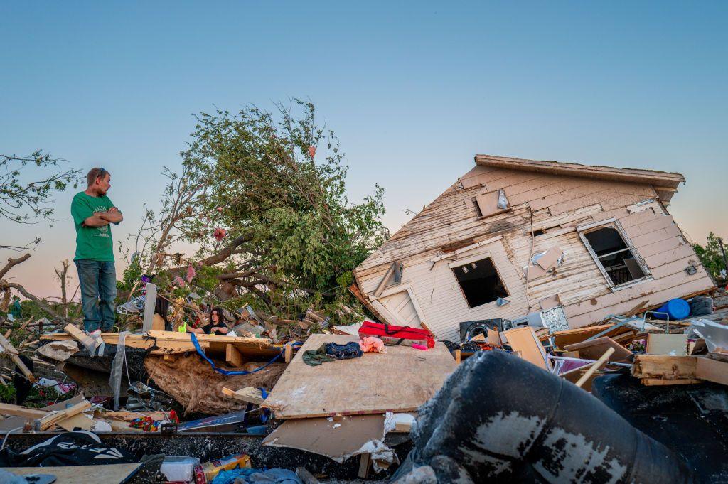
According the National Weather Service, 'once in a generation' storms have been moving through parts of the USA in recent days.
Tornadoes and violent winds have ripped through western Tennessee, Missouri and Indiana leaving homes and businesses flattened.
At least seven people have died but with further storms and "significant, life-threatening flash flooding" expected over the weekend, the risk of deadly tornadoes continues.
In Spring Hill, Tennessee, residents captured timelapse footage of a large storm cloud developing.
This is what meteorologists call a cumulonimbus cloud - one of the most destructive - that leads to thunderstorms, hail, strong winds and possible tornadoes.
What makes this timelapse so striking is the wedge of cloud forming beneath the main cumulonimbus - known as a 'shelf' or 'Arcus' cloud.
The presence of this cloud further indicates the severity of the storm system.
This type of cloud usually occurs when cold air is forced down - out of the cumulonimbus cloud, to the surface. This then pushes warmer, moister air upwards - which will cool and condense into a wedge.
- Published4 April