Why are maps useful?
Maps can be drawings or models. They can help you find where you are and where you are going.
They show symbols (pictures) for places such as car parks or places of worship like churches. They also have a key, which tells you what the symbols mean.
Maps can help you find your way using directions.
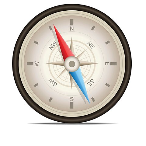
You can use a compass to find out which direction you are facing.
Here are two ways to memorise the compass points for north (N), east (E), south (S) and west (W):
- Naughty Elephants Squirt Water
- Never Eat Sugar Worms
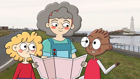
Watch: How to follow a map
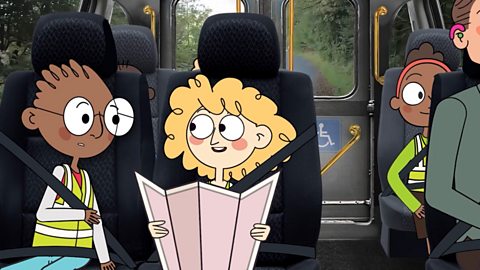
Play the video to watch Granny teach Ben and Amber how to follow a map.
Ben: Thanks for taking us out for a walk, Granny! It’s great to be by the seaside again!
Granny: I've drawn us a map, specially for this walk.
Amber: Can I have a look?
Granny: I love drawing maps! Can you see what it shows?
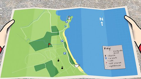
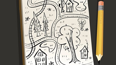
Ben: Yeah! It's like a drawing of where we are. I can see that the green bit is land, the blue bit is the sea and that yellow bit in the middle must be the beach! But what do these little pictures mean?
Granny: They are called symbols. They show clearly the places you might like to visit.
Amber: But why don’t you just use words?
Granny: If we used words, the map would look quite messy. Maps use symbols, because they don't take up as much space as words and are easier to follow! So instead of writing the word 'café', I've drawn a teacup symbol!
Amber: I get it. But what do the rest of the symbols mean?
Granny: Do you see that there is a little box in the bottom right corner of the map.
Amber: Yes!
Granny: That's called the key. It tells us what all of the symbols mean. Can you see what they mean?
Amber: That circle with a cross on the top… is a church!
Granny: Well done!
Ben: That letter ‘P’… is for car park!
Granny: Spot on!
Amber: And that’s the lighthouse, and that’s theroad!
Ben: But how can we use the map to find our way?
Granny: Well, you've already found the lighthouse.
Ben: Yes.
Granny: And we're in the car park to the south west of it.
Ben: So we must be here!
Granny: We're going to follow this path that goes between the sandy beach and the golf course. Can you see it?
Ben: There it is and if we follow it, we should get to the café!
Granny: Let’s go!
Ben: We must be going in the right direction because the beach is to the east and this golf course, is to the west!
Amber: And look! There’s the café!
Granny: Great, let’s keep going!
Ben: We made it!
Granny: Well done! I think we deserve a treat, don’t you?
Ben and Amber: Yay!
Map-reading tips
- It’s important to hold maps the right way so that you know which way, or direction to go.
- You can work out where you are on a map by looking at things around you and finding where they are on the map.
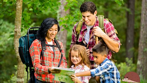
Have a look through different maps and tools:
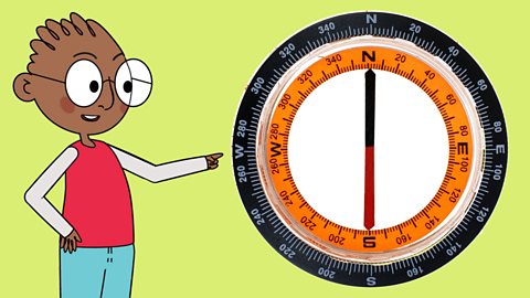
Image caption, A compass
A compass helps you find directions – N (north), E (east) , S (south) and W (west).

1 of 5
Did you know?
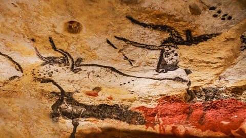
The oldest map ever found is of the stars – drawn as dots.
It was discovered next to paintings of bulls and horses, in caves at Lascaux in France.
The map is thought to be over 16,000 years old!
Activity 1: Using symbols
Activity 2: Drawing your own map
What about you?
Why don’t you have a go at drawing your own maps?
Try to think of a special place or a place you know well to show on a map, or you could use your imagination to draw a map of a place from a story you may have read or heard.
Activity 3: Quiz – Maps
BBC Bitesize newsletter. External Link
Sign up to our BBC Bitesize newsletter to receive monthly news, stories and updates on latest Bitesize content.

More on Fieldwork
Find out more by working through a topic
- count2 of 6
- count3 of 6