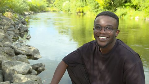
De-Graft is in Birmingham to explore urban settlements - including cities and megacities.
De-Graft: This is Birmingham, the second largest city in the UK after London, which is the UK’s capital city. And I’m about to get a real good zoomed in look at it.
A city is a large type of settlement. There’s no one definition of what a city is - it can be related to size, function, or even the presence of a cathedral.
Birmingham is one of 69 cities across the UK and later locals Alanna and Willow will be taking in the city views with me. But first, let’s zoom out…
Birmingham is in an area of England called the midlands. There are 51 cities in England, seven in Scotland, six in Wales, and five in Northern Ireland. If you look at satellite images that show the activity of the UK at night you can spot the locations of major cities from the patches of lights.
Each of the four countries that make up the UK have a capital city, where the government of that country is based and some of the country's most iconic buildings can be found. London is the capital city of England. Edinburgh is the capital city of Scotland. Belfast is the capital city of Northern Ireland. And Cardiff is the capital city of Wales.
Lots of people work in cities. Cities are known for trade and economic activity. You’ll often find tall high-rise buildings used as offices for people to work in. Such as in Hong Kong or Manhattan in New York, which are areas with extremely high population density. Not all of the high-rises are offices as lots of people also live in cities, often in flats.
Some people move to the outskirts of a city, called the suburbs, where there’s more space. People have different opinions on cities… Some people don’t like the city because it’s too bustly and noisy, whereas other people like the fact that there’s access to lots of things in one place. Cities often have many tourist attractions and are hubs of entertainment with places like museums and galleries.
Birmingham has the largest public library in the UK and I’m meeting locals Alanna and Willow on its rooftop garden to get a good view over the city.
Hey, guys, what are you up to?
Child: We are drawing a skyline of Birmingham and the buildings.
De-Graft: Now Willow, I know you want to be an architect when you’re older, what kind of buildings would you design?
Child: It would be a social club for kids and it would be shaped as a square.
De-Graft: Well we know with cities, there can be a lot of construction. Construction could mean the removal of green spaces or natural habitats. But as well as construction, we can have areas of high congestion. Now, congestion is when we have lots of traffic on the roads and fumes being pumped out into the atmosphere. Now we know that those fumes can be very harmful to the environment and can cause pollution. But there are ways of reducing congestion. Do you know any?
Child: You could use public transport.
Child: If you were going to school and you lived close, you wouldn’t have to go in your car. You could just walk or cycle.
De-Graft: Yeah, you guys are right. And some cities have initiatives like clean air zones, which encourage people to use public transport instead of using their own cars.
Do you guys have any other ideas of how we could look after our cities?
Child: For some people who are in wheelchairs like me, I would say get rid of most of the trash, so it’s not so bumpy and stuff.
Child: We could just recycle. If we have a plastic bottle or a plastic jug or something, we could recycle it or keep using it again for different things.
De-Graft: OK, time to compare… The population of London, nearly nine million people, is 100 times the size of a full Wembley Stadium. The largest city in the world is Tokyo in Japan, it is often referred to as a ‘megacity’ as the urban area spreads out so far. It covers over four times the area of London and is home to around 38 million people, that’s more than half of the entire population of the UK!
If you could design a city what would it be like? How would people get around, would it be environmentally friendly? Would you even allow cars? Zoom in and have a go for yourself.
So which one of you two is going to teach me how to sketch?
Video summary
Download/print a transcript of the video.
De-Graft cycles around the UK’s second largest city, Birmingham, exploring what makes an urban settlement, including what a city is and what a megacity is.
This film also explores what a capital city is and locates the capital cities of England, Scotland, Wales, and Northern Ireland.
De-Graft explains the type of buildings found in urban areas and the population density. He is then joined by two local children to consider aspects of urban planning including impact on the environment and making sustainable choices.
Teacher Notes
Questions to consider:
- What is a city? What shops and services might you expect to find there? How is a city different from a village or a town?
- What are the four capital cities in the UK? Have you ever visited one, and if so can you describe it? Do you know the names of any other cities in the world? Which countries are they in?
- What is the population like in cities? Why might people move - migrate - to a city?
- What do you think are some of the benefits of living in a city?
- What do you think are some of the disadvantages of living in a city?
- What is pollution? Is there more than one type? How can we reduce it?
- What ideas do you have for making our cities better and more sustainable places?
Suggested activities to further explore learning:
1. An activity around locating cities and using the terminology of an eight-point compass
- Start by asking pupils which of the UK’s capital cities is furthest north. What about east, south, west? What would you use to find out?
- Give pupils a map outline of the UK with only the capital cities marked on. Their task is to place markers on the map to indicate where other cities are using just a list of instructions based on the four capital cities. For example, Manchester is 200 miles to the north-west of London; Southampton is 100 miles south-east of Cardiff. And then they can self-check their answers and where they’ve placed the cities on the map by looking at a map of the UK online or using an atlas.
2. Design your own city:
- Pupils create an annotated map of their own new city, with sketches of some of the key features and places in it such as leisure facilities or offices.
- Encourage pupils to think about how they might organise their city. What might need to go down on the map first? What kind of housing will they create; what will the transport connections would like; how will they make it safe and environmentally friendly; and what kinds of entertainment will there be?
- What would they call their city? What would the overall vision for the city be? Could the city be created to be car free? Could it be self-sufficient in terms of clean water and food? Would it be all about being environmentally friendly, or maybe about being the most entertaining, exciting city in the UK?
- Pupils could then use junk modelling to create one of the buildings featured in their city, and present it to the class.
Key terminology:
Capital city – a city where the government of that country is based. Each of the four countries that make up the UK have a capital city (England – London, Northern Ireland – Belfast, Scotland – Edinburgh, Wales – Cardiff).
City – a city is larger than a town – usually with a population of over 100,000 people. Cities are also home to a wealth of shops and services such as schools, universities, hospitals, offices, and often a cathedral.
Clean air zones - areas where action is being taken to improve air quality, normally by charging vehicles that enter the areas. The aim is to reduce the amount of cars on the road.
Congestion – when roads are full of traffic including cars, buses and lorries.
Construction – building work often to create new roads, houses, or offices. Construction can mean the removal of green spaces or natural habitats.
Economic activity – the amount of money a city or country makes by producing and selling goods.
Environmentally friendly – goods or services that do not harm the environment or do very little harm to it.
Habitat – a place that an animal lives, where it finds food, water, and shelter. There is a huge range of habitats across the planet, from deserts to rainforests.
Pollution – when the environment is harmed or dirtied by waste or chemicals. There are three main forms of pollution: air, water, and land, although in cities noise pollution can also be impactful.
Population – the number of people living in a particular area.
Settlement – the places that people live. There are different shapes and sizes of settlement: hamlets, villages, towns, cities, and megacities.
Suburbs – an area on the outskirts of a city, often less crowded and with a bit more green space.
Trade – the buying and selling of goods and services. Cities are often especially busy areas of trade.
Transport – all the different methods used to move people or goods from one place to another such as cars or trains.
Suitable for teaching geography at KS2 in England and Northern Ireland, Progression Step 3 in Wales and 2nd level in Scotland.
Food, farming and agriculture. video
Exploring farming and agriculture - a key UK industry. Includes arable, pastoral and mixed farming and examples of rural and urban farms.
UK settlements and navigating using maps. video
Exploring the different types of settlement in the UK - including villages, towns and cities - and how to navigate using maps, including symbols, compass points and co-ordinates.
Coasts and sustainable use of natural resources. video
Examining a coastal region of North Wales, including a local wind farm and examples of the sustainable use of natural resources.
Rivers - the course of a river from source to mouth. video
Exploring the key aspects of rivers - the source, tributaries, streams, meanders, ox-bow lakes, river mouth and estuary.
Mountains - how tectonic plates create mountain ranges. video
Exploring how tectonic plate movement creates mountains where the plates collide and single peaks formed by volcanoes.
Lakes, lochs, reservoirs and the water cycle. video
Visiting Lake Windermere to consider lakes, lochs and reservoirs and their place in the water cycle.
Forests - deciduous and coniferous woodland and biodivsity. video
Exploring a forest region in the Lake District to discover the rich biodiversity of woodland habitats.
Shore, coast and ocean. video
Visiting a marine reserve in Scotland to discover the biodiverse habitat it offers, but also the importance of conservation.
Peatlands, wetlands and the carbon cycle. video
Exploring the significance of peatland and wetland habitats to store water and absorb carbon or CO2.