'Once in a generation' rainfall forecast as huge storms sweep North America

- Published
Huge areas of the US are preparing for potential flooding and tornadoes with storm risks upgraded to their highest levels, as authorities describe them as 'once in a generation'.
Officials say there has been at least one fatality and warn that the worst may yet be to come.
The same area of low pressure will also deliver yet more snow and freezing rain to eastern Canada which experienced a powerful ice storm last weekend.
In addition, the high winds and a surge of low humidity will increase the chance of further wildfires to parts of the desert south-west.

A deep area of low pressure will track eastwards with severe storms breaking out on the trailing cold front, marked with blue arrows to the south
Flash flooding
Several days of torrential rain are likely to lead to extensive, catastrophic flash flooding which could be life-threatening.
It has been described by NOAA, the US weather service, as a 'once in a generation' event.
Over the next few days relentless rainfall could bring as much as 10in (250mm) over Kentucky, Tennessee and Missouri, leading to huge accumulations of water in a relatively short period to time.
Totals of 12-15in (300-300mm) have been predicted across the state of Arkansas.

The US weather service NOAA has issued the highest level warnings for some areas - shown here in pink and red
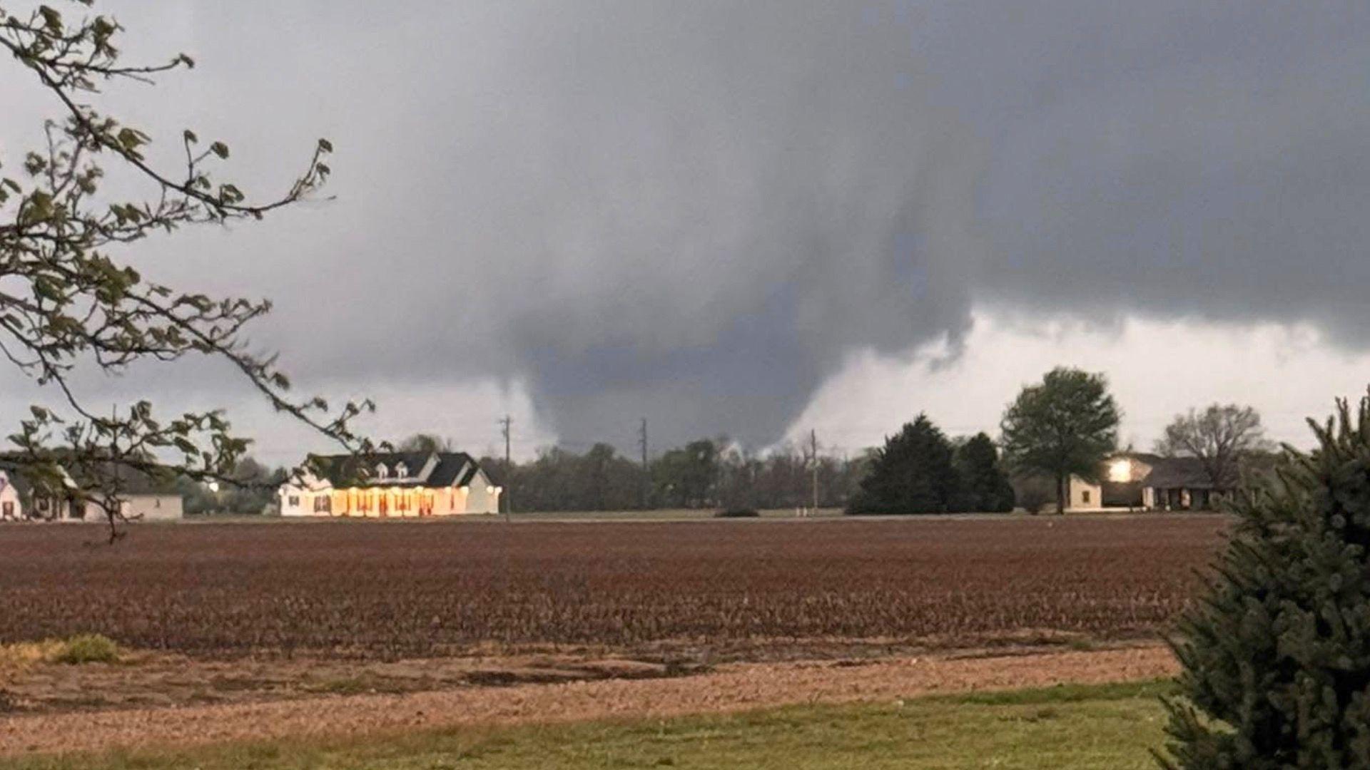
Severe thunderstorms and tornadoes
Warm, moist air flowing in from the Gulf of Mexico will be responsible for triggering severe thunderstorms along the cold front affecting areas from central Texas to the Midwest.
The high level warnings include those to cover a 'tornado outbreak'. On Wednesday there were 21 reported tornadoes mainly over Missouri and Kentucky, with some in Illinois and Arkansas.
Officials said one person was killed in Tennessee and there has been widespread damage reported.
Threats continue across the Central Plains including multiple strong tornadoes, damaging winds, large hail and flash flooding.
Winter storms

An ice storm hit south-eastern Canada last weekend with snow and freezing rain
The area of low pressure is pushing eastwards and will bring more snow on the leading edge to north-eastern parts of the US and south-eastern Canada where storm watches are in force.
As mild air tucks in behind there will be the risk of freezing rain and ice on Thursday and Friday. Freezing rain occurs when sub-zero water droplets fall on surfaces and freeze on impact creating particularly dangerous travelling conditions.
There is likely to be a further 6-8in (15-20cm) snow in Quebec and the brisk easterly winds will cause blizzard-like conditions.
Since Tuesday some areas of Minnesota have had 10-12in (25-30cm) of snow with 8in (20cm) in North Dakota.
Wildfire risk
The second highest level of alert has been issued for wildfires continuing for much of the rest of the week.
With brisk south-westerly winds and low humidity behind the front there is a critical wildfire risk for parts of western Texas, New Mexico and Arizona.
- Published3 April