Where to start planning fieldwork
When you plan your fieldwork investigation, you need to think about:
- how to choose the location
- physical and human features
- what to investigate
- how to collect information
- how to record data
- how to stay safe
What do you need to plan before your visit?
Before visiting an area to do your fieldwork, you need to plan exactly what you are going to do and how you are going to do it.
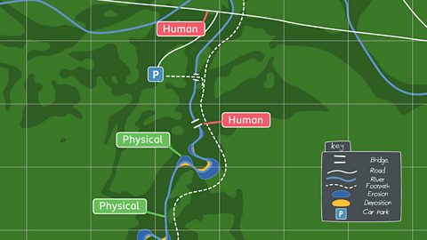
Looking at maps of the area will help you to decide what you could investigate. You could look at human features or physical features – or even both.
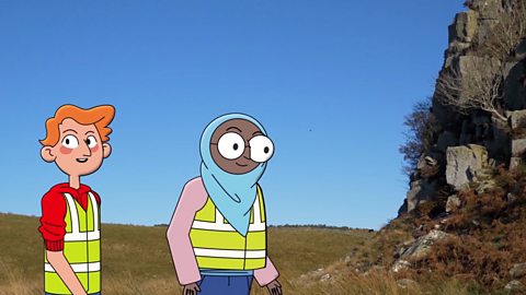
Watch: Rivers fieldwork investigation
Watch the video to see Ayesha and James plan their fieldwork investigation at the river.
Ayesha: What do you want to find out when we do our fieldwork, James?
James: I want to see if the valley was formed when a spaceship crash landed!
Ayesha: Or we could find out how a curvy part of the river is different to a straight part.
James: Oh… yeah! That would be a good one too.
Ayesha: We'll need to do drawings of the landscape to show the shape of the river.
James: I'd like to know how fast the river flows. We could get some rafts and float down the river.
Ayesha: You don't need to be in the river to do that! You can float things down the river and see how quickly they move from one point to another.
James: An orange! It won't harm the river, it's easy to see and it floats!We could look for human and physical features.
Ayesha: I could draw a map showing the physical features created by the river, where we can see river banks or soil erosion.
James: And we can add human features like paths and bridges!
Ayesha: OK, I think that'll give us plenty of information and I don't think there'll be enough time to do any more than that.
James: I think I've found the perfect place!
Ayesha: Where?
James: Here!
Ayesha: This place isn't too far from the car park and there's a path we can take.
James: It's near a bridge too! So we can use it to drop the orange.
Ayesha: We'll need to be careful on the river banks where the soil is soft or we could fall in!
James: And we'll also need to stay with the group, so that we're near the grown-ups and wear those bright yellow vests!
Ayesha: Great. We've got it planned out! So we know exactly what we're doing when we get there.
James: And we know that we'll be safe!
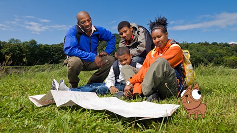
Tips for planning

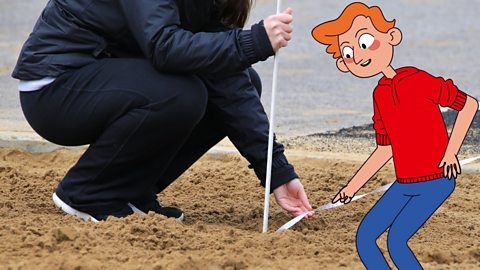
Image caption, Choose your location
Looking at maps can help you choose your fieldwork location. You could also think of what you already know about the area.


1 of 6
Watch: What do you need to wear?
It’s important to always consider dressing for the weather and the terrain (type of ground). This is all part of good planning.
Find out more by watching this BBC Teach video about a day out in the mountains.
De-Graft: I’m in Wales, finding out about the country’s tallest mountain - Snowdon. It takes a good few hours to walk up and down it. But thankfully there’s a train you can catch too.
Mountains are high areas, rising more than 600 metres from the surrounding land. And often they’re found in groups called mountain ranges. This is Snowdon. The summit, or top of the mountain, is over 1000m high and it’s part of a mountain range called Snowdonia. Later locals Iola and Oliver are going to be helping me think about climbing mountains and how you can prepare.
But first, let’s zoom out. Snowdon is here in North Wales. The highest mountain in the UK is actually in Scotland and it’s called Ben Nevis. Slieve Donard is the highest in Northern Ireland. And Scafell Pike is the highest mountain in England.
Mount Everest is perhaps the most well-known mountain in the world. It has the highest peak above sea level at 8,848 metres. Mount Everest is part of the Himalayan mountain range in Asia where many of the world’s tallest mountains are found. Earth’s surface is made up of different sections called tectonic plates. Most mountains are fold mountains, which means they’re created when two tectonic plates collide, and they force the ground up where they meet. Like this…
Other mountains are created by ancient volcanoes. These are often individual peaks. Ben Nevis in Scotland and Snowdon here in Wales were once very large active volcanoes. They last erupted millions of years ago. Another cool thing about mountains is that they can affect the weather as clouds carrying water droplets are pushed up and over the physical barrier of the peak, they move into colder air, lose their energy and then drop their load as precipitation: rain, hail, snow or sleet.
I’m meeting Oliver and Iola at the bottom, or base, of Snowdon. We’re packing backpacks to prepare for a hike.
What kind of things do you have in your backpack?
Oliver: I have an emergency survival kit. First off, we have a whistle, to make sure that people know where you are and if someone is in danger.
Iola: If you go up the mountain and you get really thirsty, you’re going to need a drink. If you don’t drink, sometimes you can get a bit tired, so it’s good to always stay hydrated.
De-Graft: Nice. So, we’ve got a map here. Do you guys know what the numbers and lines mean?
Oliver: The numbers means how high up the mountain is.
Iola: The more where there's loads of orange lines together, it means that it would be steeper to climb up.
De-Graft: Yeah, you guys are pretty much there. We call that contours. The closer the lines are to each other, the steeper the hill or the mountain is. The further away they are, the more gentle the slope is. Now we can use contours to help us prepare for a route when we’re hiking, to decide whether we want to hike on a steeper route or a more gentle slope.
What do you think the weather is like at the top of a mountain?
Iola: I think it would be quite windy and snowy.
De-Graft: Yeah, you’re right. Did you know that on tall mountains, like Mount Everest, it’s so high up that people need oxygen masks to help them breathe, because the higher up you go the thinner the air gets.
OK, time to compare… Snowdon is the same height as around 240 double decker buses stacked on top of each other! Mont Blanc, one of the tallest mountains in the Alps in Europe, is 4807 metres, over a thousand double deckers tall.
So, is there a hill or mountain near you that you could explore? Why not try and find it on a map? Zoom in and have a look for yourself.
Right, off you go then guys. But, just double checking, there is a train we can get, right? No?
Did you know?
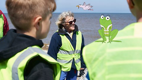
Fieldwork can take place anywhere, for example in rivers, by the coast, in towns and cities and even in the hills and mountains.
Activity: Quiz – Planning fieldwork
SATs preparation resources. activity
Get ready for the SATs papers with videos, activities, quizzes and games to refresh your knowledge and practise your skills.

More on Fieldwork
Find out more by working through a topic
- count7 of 12
- count8 of 12