Travelling by road
Roads are essential for connecting people, places and industries.
In this article you can learn:
- where roads are built and why they are built there
- some types of road you might find in Scotland
- why we need roads
- the A9 and why it is important
This guide is suitable for learning about People, Place and Environment topics in primary school.
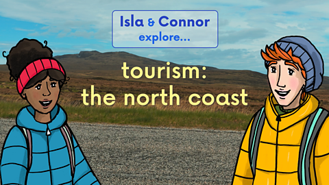
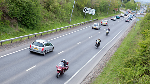
Video - Travel and transport on the A9
Join Isla and Connor as they travel up the A9 road by bus. They learn about different types of roads and why we need them.
ISLA: I am looking forward to visiting Dalwhinnie and Loch Ericht It's so high up in the mountains.
CONNOR: Just over a hundred miles to go before that along the A9.
Which is the longest road in Scotland. Its 439 kilometres or 273 miles.
ISLA: Look how the road wiggles around.
Couldn't someone just build a straight road to get there and half the time?
CONNOR: A straight road gets where it needs to go faster.
But there are things in the way.
A road connects people, places and industries.
It has to find the best route across rivers and go where the most useful stops are.
And they aren’t always in a straight line and the road has to go around and mountains or other obstacles.
ISLA: Someone knows a lot about roads!
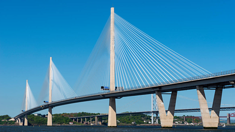
CONNOR: The Forth Bridges.
ISLA: Wow. They're impressive. We're crossing the Firth of Forth.
Before the bridges were built. There was a ferry crossing here.
CONNOR: The ferry was the original way of crossing the river.
Then the first bridge was built for the railway during the Victorian era when trains were the main type of transport.
Finally, the invention of cars brought more road transport and a bridge for carrying cars across the river was built back in 1964.
53 years later in 2017, the newest bridge, The Queensferry crossing opened. It's much stronger and can carry more traffic, including us.
ISLA: That's a lot of updates.
CONNOR: Another update is where the A9 is being widened, adding extra lanes to the road means slower vehicles can be overtaken by faster ones.
Adding a barrier between traffic heading in opposite directions makes this dual carriageway and means vehicles are allowed to go faster.
More cars use the road today than when it was first built, so the extra lanes help it cope with the extra traffic.
ISLA: More traffic is an issue. It increases road accidents and adds pollution to the environment.
Petrol and diesel vehicles release greenhouse gases that contribute to global warming and are harmful to our health.
One way to reduce this is to use public transport, like this bus. More public transport means fewer cars.
Better for the environment, right?
CONNOR: The A9 has one of the best electric vehicle charging networks in Europe.
Electric cars are much better for the environment. They don't emit greenhouse gases or air pollution and if they get their energy from renewable electricity, then they aren't contributing nearly as much to global warming.
But over long distances electric cars need to recharge. Projects like Electric A9 can help make travel greener by providing lots of recharging points.
ISLA: Wow. That’s definitely good news.
We're not far from our stop at Dalwhinnie in the Grampian Mountains.
Look at the map. The road has taken a long loop West and is about to curve back East, another one of those wiggly bits.
CONNOR: The Grampian Mountains cover more than half of Scotland. This is one of the major obstacles for the road to get through.
Thousands of years ago, glaciers, huge rivers of slow moving ice eroded, these valleys between the mountains, making them wider and flatter.
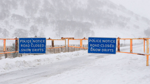
Today we can use these wide, flat routes through the mountains as safe passes. When there is a lot of snow, the Drumochter Pass is easier to get through than other routes, but sometimes even this road gets too snowy.
This is our stop, Dalwhinnie.
ISLA: Let's go and have a wander around, Connor.
No, straight lines! I want to explore properly!
Why do we need roads?
Nowadays, roads allow people to get from home to work or school, receive goods and supplies and visit friends and family. There are lots of roads in big towns and cities, and other roads that join places together. In the past, many roads were built:
- along A route that allows travel between places for buying and selling goods. , so the roads or tracks had to be suitable for Farm animals kept for profit such as cows, sheep or goats. to travel long distances.
- for armies to travel long distances, sometimes on foot, to an important A place where people live. or castle.
Types of road
In Scotland, there are several different types of road, including:
- motorways
- A and B roads
- single-track roads.
They all have their part to play in keeping people connected.
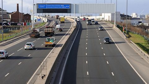
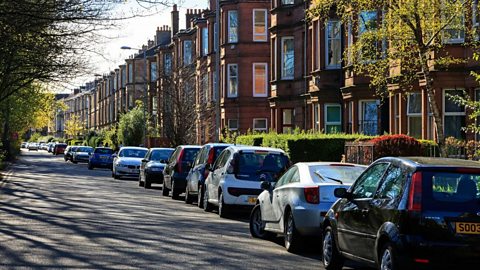
Image caption, Motorways
Motorways link our cities, where more people live and work. They allow vehicles to travel faster and more directly. Scotland has a small motorway network, including the M8 which runs between Glasgow and Edinburgh. This picture shows the M8 in central Glasgow. Some slower or smaller vehicles, like bicycles, small motorbikes or tractors, aren’t allowed on motorways. (Douglas Carr / Alamy Stock Photo)
1 of 8
Road safety and the Highway Code
Everyone who travels by road must follow a set of rules called The Highway Code. These rules are designed to keep the roads safe for everyone - drivers, motorcyclists, cyclists, pedestrians and other road users.
The Highway Code covers everything you need to know to use the road safely, including:
- vehicle and cycle maintenance, such as checking brakes and lights are in working order.
- speed limits for vehicles on different types of road.
- traffic lights, road signs and markings.
- rules for using the road in different conditions such as bad weather and at night time.
- basic safety measures, such as wearing seatbelts in cars, not using mobile phones while driving and cyclists using white front and red rear lights at night.
These rules are updated regularly to help all road users to stay safe. All new vehicle drivers must pass a test to show their knowledge of the Code before they can get a driving license.
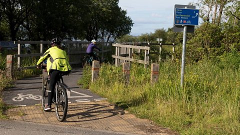
Cyclists can choose to build their confidence on the roads and demonstrate their road awareness using the National Standards in Cycle Training or Bikeability courses - but these are optional.
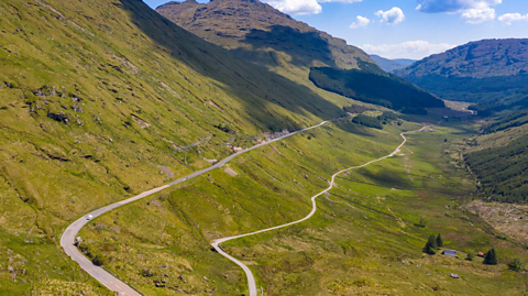
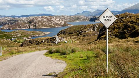
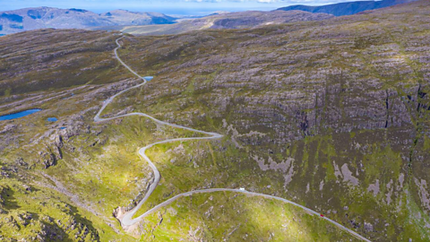
How do roads affect the landscape?
As well as following old military and trading routes, new roads have to be built around the landscape they're in. They can't always go from A to B as there might be mountains, thick forest, or rivers in the way. The route roads take and the features they have can help make travelling safer.
Here are some examples of roads in Scotland that work with the surrounding landscape.
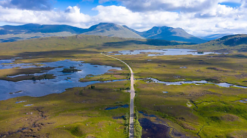
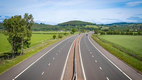
Image caption, Rannoch Moor
This is the A82 running through Rannoch Moor. Notice how straight the road is when there is nothing else on the moor, until it has to weave through the two small lochs. This is why roads in mountainous or coastal landscape can often be very bendy as they have to fit around the existing landscape. (Iain Masterton / Alamy Stock Photo)
1 of 5
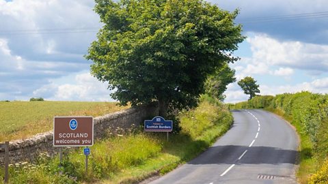
The A9
The A9 is the longest road in Scotland. It is 273 miles, or 439 km long.
- It used to be the main road between Edinburgh, the capital, and John o' Groats, one of the most north-eastern points on the Scottish mainland.
- Both ends of the route have changed over time.
- There are new motorway sections carrying more traffic from Edinburgh in the south to Stirling and Perth.
- The north end of the road is now at Scrabster Harbour near Thurso, where you can catch an onward ferry to Stromness in Orkney.
- It is still the major route connecting the Central Belt and Highlands of Scotland. The road has had to be adapted for larger, faster vehicles and an overall increase in traffic. Without improvements to let traffic flow more smoothly, there would be more Pollution is when substances that are harmful are introduced into the environment. and When roads are filled with too many cars and vehicles, the roads become congested and the traffic slows down or stops completely. on this route.
The proposed changes to the A9 include:
- making 30 sections of the road a dual carriageway so that it is safer for large amounts of traffic to travel in busy conditions, and at high speeds.
- installing electric chargers and charging hubs along the route to encourage people to use electric vehicles
- providing more safe crossings for other road users (especially cyclists and pedestrians)

Key words about roads and transport
Check your connection, refresh the page and try again. - A major road with a central reservation separating traffic travelling in opposite directions.
Check your connection, refresh the page and try again. - The release of carbon in to the earth’s atmosphere which contributes to climate change.
Check your connection, refresh the page and try again. - Gases in the atmosphere that trap heat. Although they are needed to keep Earth warm enough for life to exist, there is now too much of them, contributing to climate change. Carbon dioxide is one of the greenhouse gases.
Check your connection, refresh the page and try again. - A network of electric charging points that allow drivers to charge their electric vehicles, therefore cutting down on carbon emissions released from petrol and diesel.
Check your connection, refresh the page and try again. - when substances that are harmful are introduced into the environment.
Check your connection, refresh the page and try again. - when roads become overcrowded with cars and other vehicles, so traffic slows or stops completely.
Check your connection, refresh the page and try again. - a place where people live
Check your connection, refresh the page and try again. - a set of road safety rules and guidance for all road users
Test your knowledge
Quiz
Challenge

Design some safe, green roads
It's not only big roads like the A9 that need to be safe for all users. Think about a route you often take, to school, a local park or to visit family and friends. Think about the roads you have to cross and the vehicles that travel on them. Could you design a safer, more environmentally-friendly way for everyone to travel? Maybe draw a map of the route, with the important places marked.
Here are some things you might want to think about or research for your map:
- crossings and other safety measures
- speed of the traffic and how busy it might be
- pollution
- the type of road
- paths for road users who aren't in vehicles
Our landscape
The young people from North Queensferry Primary School made a short film all about the Forth Bridges, their local landmarks.
We are pupils from North Queensferry Primary School and this is our video about the most important landmarks near our school.
Before the bridges were built, ferries ran between North and South Queensferry dating back to the 12th century. The villages were named after Queen Margaret. Over time, the ferries were replaced by three bridges, one for the trains and two for motor vehicles. Here are some facts all about our amazing bridges.
The Forth Railway Bridge is one of Scotland's most famous landmarks. It is a UNESCO World Heritage site. It was opened in 1890 by the Prince of Wales. It runs between Dalmeny and North Queensferry stations. Over 4000 men were involved in its construction and it took around seven years to complete. 6.5 million rivets were used in the making of the bridge. The bridge is 2467 metres long. The highest point of the bridge stands at 110 metres above the river.
The Forth Road Bridge is a suspension bridge and its towers are 156 metres tall. The bridge was designed by architect firms Mott, Hay and Anderson and also Freeman Fox and Partners. It's one and a half miles long and is a category A listed building. The bridge connects Fife to the Edinburgh area. It contains 39000 tonnes of steel and it cost £19.5 million. It was opened on September 4th, 1964, by Queen Elizabeth II. When it opened, it was the longest bridge of its kind outside of the USA. The Road Bridge closed as it had exceeded its design capacity. It closed for cars in August 2017, but is still open to buses, some motorbikes and taxis.
The Queensferry Crossing is the newest of the three bridges in our local area. It took six years to build. It was opened in 2017 also by Queen Elizabeth II. It’s the longest three tower cable-stayed bridge in the world. The towers are 210 metres above the high tide mark in the river. That’s around the same height as 48 double decker buses. It is 2700 metres long. It contains the same amount of steel as 200 large passenger jets. Thank you for joining us. We hope you learned something new. Bye.
More to learn about road safety and transport
Road Safety External Link
Road Safety Scotland's advice on road hazards (this link directs to an external site)
Energy and transport
BACK CHAT

Transport and Sustainability
Learn more about sustainable transport
More on Landscapes
Find out more by working through a topic
- count7 of 25
- count9 of 25
- count10 of 25