Paul:
The Ribble is a beguiling river, powerful in parts and tranquil in others. And it's one I've always wanted to fish. I'm visiting the small rural village of Wigglesworth for a very different reason. 20 of the area's finest, young and old, have been brought together by the Ribble Rivers Trust, led by Jack Spees.
Hello Wigglesworth.
Crowd:
Hello.
Paul:
Very nice to meet you all. Thank you very much. Good welcome. Jack.
Jack:
That's right.
Paul:
Hello, Paul. Jack, you're the CEO of the Ribble Rivers Trust.
Jack:
That's correct.
Paul:
You try saying that.
Jack:
No, I have.
Paul:
Tell me what you're doing today.
Jack:
So we're doing the River Blitz on Wigglesworth Beck. We are going to go out and take some invertebrate samples, some water quality samples, have a bit of a look at the habitat.
Paul:
Do I need my waders?
Jack:
Definitely.
Paul:
OK, all right. Come on then, guys. Come on.
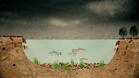
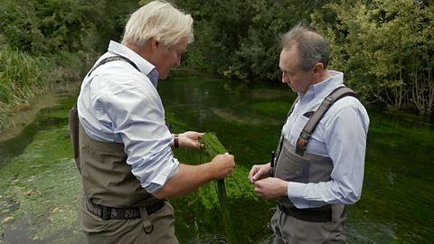
The Ribble Rivers Trust was formed in 1998 by just six volunteers. Now, there's a core team of eighteen employees and an army of volunteers. Today, the team are spread out along Wigglesworth Beck, a small tributary of the Ribble, to assess the water quality by taking a sample of the life in the riverbed.
So you don't care, do you? You just throw your children in the river there and let me get on with it, don't you?
Woman:
Yeah. I think it's really important for them to learn what's going on with the rivers and the water at the minute because, ultimately, they're the ones that are going to be inheriting it.
Paul:
Wow. It's absolutely teeming with life.
Woman:
Yeah.
Paul:
What's that?
Jack:
Uh, a shrimp.
Paul:
OK. Look at your Mayfly. And what is this rather sinister thing here going? Look.
Jack:
Those are our-
Man:
Crane flies.
Boy:
They're all wrestling each other.
Paul:
Yeah.
Jack:
The only challenge is, we got to identify and then count them all.
Boy:
Ramshorn snail.
Woman:
Well done boys.
Paul:
Yeah, you know more than I do boys.
Boy:
Crane fly there, Crane fly.
Paul:
Wow.
Jack:
Green Drake
Paul:
Is that a Mayfly then?
Jack:
Yeah.
Paul:
Yeah, look at this, these Mayflies.
Boy:
Oh, caddisfly.
Paul:
Yeah, a little tiny caddisfly.
Jack:
Little tiddlers.
Paul:
Well you must be, um.
Boy:
Oh, flat body.
Paul:
Yeah, there's a flat body, I saw that. I know that.
Man:
How did you know?
Paul:
Well, Jack, you must be very pleased with what you're seeing here.
Jack:
Yeah, yeah.
Paul:
It's incredible, isn't it? This amount of life.
Jack:
And the fact that we're seeing the Green Drake, the Mayfly, they are so intolerant pollution, to have got as many of them as we have is, is such a good sign.
Paul:
Yeah.
Jack:
Couldn't be much happier.
Paul:
Yeah. Fantastic. Whilst the Trust is having a positive impact on improving water quality and habitat for aquatic life, there is a large cloud looming, that is now one of the biggest concerns for Jack.
Climate change. In the past, many waterways were straightened to maximise land use, increase the flow of water for mills and carry unwanted human sewage away from housing quickly.
Drastic flood events brought on by climate change are actually enhanced by the straightened waterways.
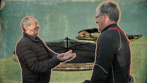
Jack has brought me to one of the Trust's largest scale projects looking to mitigate the impacts of climate change.
Jack:
Yeah, so you can see here exactly what we're doing. Opening up that channel, trying to get those bends back in the stream or the technical term, to re-wiggle. Genuinely, genuinely.
Paul:
Is it actually called re-wiggling?
Jack:
Yeah, yeah, it is absolutely the technical term.
Paul:
You've made that up.
Jack:
So, we had a survey done on the ground here and we were able to identify where the old channel used to be so we've put these little blue flags out to mark where the channel should be. And so the digger can follow along and make sure that we are getting it right.
Paul:
Climate change is the, sort of, dark horse that's stalking all of us, and it, and all the work and effort that's being done to improve things, it's got that big underlying threat. How are these measures helping in the, sort of, the small scale fight against global warming?
Jack:
Yeah, so where Ged Beck was straightened, it essentially from the start of the straightening to the end, it's about 93 to 100 metres. What we've now done here is extended that to 230-odd metres.
So it takes longer for the water to get from, you know, the upstream bit to the downstream, and that's slowing the flow and it's reducing the flood risk downstream and we know that climate change is going to see our flood risk increasing.
Paul:
Right.
Jack:
What the digger driver is trying to do, as best he can, is save some of the turf that he's stripping and put that back. We'll probably come and put some grass seed on a few rushes, you know, some sort of marginal habitat.
But, overall, you know, the big thing is that we're extending the river by 133 metres. So we're getting 133 metres of river habitat back.
Paul:
Yeah. So what do you expect to see here, say in about a year?
Jack:
So, based on what we've found downstream, I think we can expect eels, but there's an outside hope that we might see some salmon and some tripe starting to sneak in.
Paul:
I mean, at the moment you can't imagine. Any, any self-respecting salmon would turn its nose up and head right back to Lancashire.
Jack:
Absolutely. Absolutely.
Paul visits the River Ribble in Lancashire to assess the habitats living in the water.
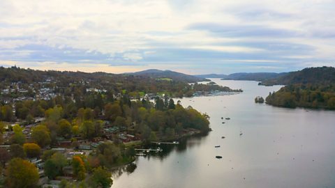
The River Ribble is one of the UK’s longest rivers and flows for a journey of 72 miles (116 kilometres) from its source at Gayle Beck, near Ribblehead, to its estuary near Lytham.
The Ribble travels through the counties of Yorkshire and Lancashire, including part of the Yorkshire Dales National Park and through major settlements such as Settle, Clitheroe and Preston, before reaching the Irish Sea.
It is negatively affected by pollution, and by hazards associated with climate change such as flooding. This clip shows how monitoring biodiversity can help assess river health, and also discusses how ‘re-wiggling’, or putting the meanders back into rivers, can alleviate increased flood risk.
This video is part of UK rivers case studies, a series of clips taken from Paul Whitehouse: Our Troubled Rivers – available on BBC iPlayer.
Teacher Notes
Before watching the film:
- Using digital mapping software such as Digimaps, Arc GIS, or Google Maps, ask students to locate the River Ribble in England and identify where it rises, where its mouth is and which counties it flows through.
- Ask students for any other additional information that the map might reveal, such as the names of large settlements that the River Ribble passes through, or type of landscape terrain. Ask students if anyone has heard of the river or even visited it.
- Recap some of the impacts of climate change affecting rivers in the UK, such as the increased incidence of extreme weather events, and identify some of the impacts on people’s everyday lives, eg through flooding.
During the film:
- You may wish to stop at relevant points during this short film to pose questions and check understanding or wait until the end. Useful questions might include:
- Checking vocabulary eg: What is a ‘beck’? What is a ‘tributary’? What is a river ‘catchment’?
- Noting how useful monitoring and recording species diversity is when considering river health and the amount of pollution in it, eg:
- Why are the volunteers monitoring and recording the diversity of aquatic life found in the beck?
- What does it mean for a species to be ‘intolerant to pollution’?
- What aquatic wildlife were found and what does this say about the health of this tributary?
- Considering why people in the past straightened sections of rivers, eg:
- Why is it many waterways had sections straightened? (In the past this was to maximise land use, increase water flow to mills, and carry sewage away from settlements as quickly as possible).
- Can you explain why straightening sections of rivers causes problems? (Straightening rivers increases water flow so that in periods of heavy rain, flooding becomes more likely further downstream).
- Why are people now ‘re-wiggling’ rivers? (To slow the rate of flow and reduce flood risk, provide additional river length and more habitat space, and to attract aquatic wildlife such as eels and salmon).
Following on from the film:
- Freeze frame a view of the landscape on the screen and ask pupils to create an annotated sketch map. This is a useful skill to practice before going ‘out in the field’.
- Ask students to research more information about the project to re-wiggle the Ribble tributary and create an annotated sketch map explaining what is happening and why. (Or identify a project to re-wiggle a stretch of waterway in your own local area).
- Check incidences of flooding on the Ribble, creating graphs and maps to show alert areas, river height over time and rainfall recorded over a period using the government flood alert website.
- You could also investigate flooding in your own area using this government website.
- Plan for fieldwork at a water course near you. This might be measuring biodiversity in a local stream, or investigating part of a local waterway with a view to making recommendations as to how actions might mitigate against flooding hazards.
Curriculum Notes
All these short clips build on students’ understanding of human and environmental interactions and provide opportunities to practice geographical skills such as enquiry, mapping and fieldwork.
At KS3, students can learn more about how human and physical processes interact to influence, and change landscapes, environments and the climate.
At KS4, the film supports understanding about fluvial environments, flooding hazards and climate change, environmental management and fieldwork investigation.
The film might also be used for example, to contribute to case studies about human interactions on fluvial environments (CCEA), and about environmental challenges (WJEC).
This clip could be used to support the delivery of geography to KS3 and KS4 students.
Specifically, this topic appears in OCR, Edexcel, AQA, WJEC KS4/GCSE in England and Wales, CCEA GCSE in Northern Ireland and SQA National 4/5 in Scotland.
Further clips from Paul Whitehouse: Our Troubled Rivers
Water industry privatisation. video
A look at the background to the privatisation of ten regional water authorities in 1989.

River Wharfe and wastewater systems in the UK. video
Paul visits the River Wharfe in Ilkley, West Yorkshire to see how it is affected by pollution from sewage.
Lake Windermere eutrophication. video
Paul visits Lake Windermere to hear how tourists may be contributing to pollution levels.
Beavers and rewilding in the UK video
Paul visits the River Tamar in Devon to hear about a project that aims to let nature restore ecosystems.

Pharmaceutical pollution in the River Clyde video
Paul visits the River Clyde in Glasgow to hear about pharmaceutical pollution and its consequences.
River Tame microplastic pollution. video
Paul learns about how microplastic pollution affects the River Tame in Greater Manchester.
River Test and UK chalk streams. video
Paul visits Hampshire to look at a very rare habitat – England contains 85% of all chalk streams in the world.
River Thames Tideway project video
Paul visits the construction site of a 'super sewer' in London.
Intensive chicken farming and the River Wye video
Paul looks at how agricultural pollution is affecting the River Wye.