Paul:
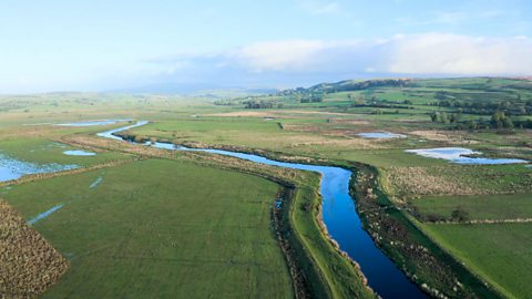
I'm back on the road and heading north to one of the jewels in the British landscape, the Lake District.
The largest national park in England, the lakes covers an area of over 2,000 square kilometres and has a population of 40,000 residents, but that is immensely inflated by tourists with almost 20 million visiting in 2019.
So it's a place of vast importance, both culturally and economically. But even this rural haven, isn't free from the threat of river pollution
News broadcast 1:
Prolonged high temperatures have resulted in harmful algae bloom spreading across England's largest lake.
News broadcast 2:
Earlier this month, parts of Windermere turned green. Algal blooms can occur naturally but they're made worse by sewage, runoff from farmland and septic tanks.
Paul:
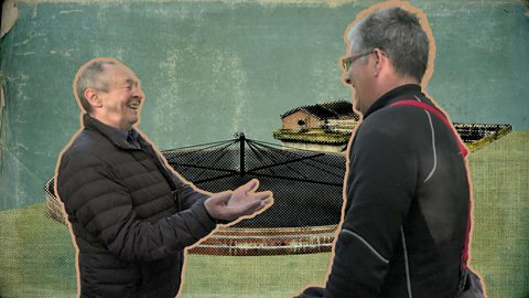
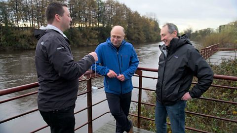
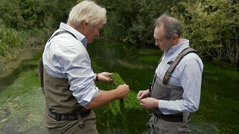
The pressure from sewage as well as agriculture and tourism is having a major impact on the very thing that draws people to the area: Lake Windermere. And campaigners like Matt Staniek are worried for the lake's future.
Matt:
So, this is the north basin. See where all those islands are… just past that, the lake splits into essentially two millponds. From that end to that end, this summer, this entire area was blue-green algae.
You could see it from space - there's satellite imagery to show the extent of this bloom and it peaked on the thirteenth of August.
And you know this is an oligotrophic lake in its natural state, which means extremely low in nutrients.
And in an oligotrophic lake, you will not see cyanobacterial blooms.
And the reason that now Windermere's eutrophic, which is extremely high in nutrients, is the human impact that we're seeing and this is just getting worse and worse as more people visit here and put too much pressure on inadequate infrastructure.
And we've got big tourism industry - I mean look at the tourists that are driving past us right now.
My big fear is that in the bed of the light, right at the bottom, we've got this layer of sludge which is essentially decades worth of pollution that has collected at the bottom and sits there.
It's extremely high in nutrients and this in itself is going to create a whole lot of issues, if it finds a way to the surface of the lake.
Paul:
It's crying, isn't it, in anguish saying, 'Do something about this'.
Matt:
That's my biggest pet peeve of this situation. Why does it take something terrible happening for us to actually say, no, we should put an end to sewage pollution in the Lake District National Park. I
It's dying, you know. What's going to happen when someone dies in Windermere, if it smells like rotting dead fish?
No one's going to come here. This isn't just looking at the next five years of Windermere.
We have to look into thirty years' time. What's going to happen - and what do we need to do?
We need to invest in the infrastructure.
Paul visits Lake Windermere in the Lake District to speak to environmental campaigner Matt Staniek about pollution levels, and how tourists may be contributing to this.
The Lake District is England's largest National Park and covers an area of 912 square miles (2362 square kilometres).
Within the area of national park can be found England’s highest mountain, Scafell Pike (3210 feet/978 metres), and England’s largest lake, Windermere.
The Lake District is of significant cultural and economic importance and attracts millions of visitors.
In 2019, its modest population of 40,000 people was visited by 20 million tourists.
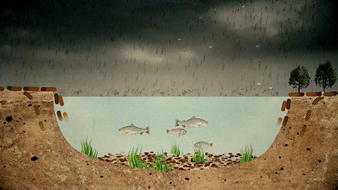
In recent years Lake Windermere has suffered from algae blooms, which can occur naturally but are made worse by a combination of high temperatures, the presence of nutrient-rich sewage, and run off from farmland and septic tanks.
In its natural state Windermere is an oligotrophic lake, which means it is low in nutrients and high in oxygen.
The rise in nutrients from pollutants is transforming the lake into a eutrophic state, causing low oxygen levels and detrimental impacts on wildlife.
The pressure of visitors is a contributing factor to the pollution, damaging the environment that attracts tourists in the first place.
This video is part of UK rivers case studies, a series of clips taken from Paul Whitehouse: Our Troubled Rivers – available on BBC iPlayer
Teacher Notes
Before watching the film:
- Recap what students know of the Lake District. Locate it on a map and ask students to explain why it is such an iconic landscape and its importance as a National Park.
- Ask students to suggest what the impact of large visitor numbers might be on the environmental health of the lakes as well as other detrimental factors.
During the film:
- If students have not been fully introduced to the terms oligotrophic and eutrophic, reinforce these terms when they appear and check students’ understanding.
- Ask students to identify any other words and phrases during the film that would be useful to create a glossary and to note causes and impacts of the environmental threats affecting the lakes.
Following on from the film:
- Using their glossary and understanding of causes and impacts, students could work in pairs to create a diagram and short presentation, explaining the causes and impacts of eutrophication in Windermere.
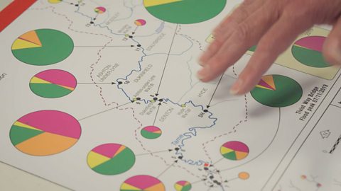
- Students could map evidence of algae blooms in Lake Windermere as provided by the Environment Agency onto digital maps. They could then discuss the relevance of the dates and locations of recorded incidences.
- Using the evidence from the film and other research, such as newspaper articles, ask students to create a list of facts explaining the situation. Which factual statements can they be certain are true and why? Where has the evidence come from and is it verifiable from other sources?
- Ask students what the long term impact of this pollution might be for the region as a whole in environmental, social and economic terms. What workable solutions might they propose?
- There may be local opportunities for fieldwork investigating the impacts of tourism and/or agricultural practices on local environments.
Related Links:
BBC:
Other:
Curriculum Notes
All these short clips build on students’ understanding of human and environmental interactions and provide opportunities to practice geographical skills such as enquiry, mapping and fieldwork.
At KS3, students can learn more about how human and physical processes interact to influence, and change landscapes, environments and the climate.
At KS4, the film supports understanding about fluvial environments, flooding hazards and climate change, environmental management and fieldwork investigation.
The film might also be used for example, to contribute to studies of small scale eco-systems (CCEA), how human activities modify processes and interactions within ecosystems (WJEC), and the impact of conflict between social, economic and environmental needs (SQA).
This clip could be used to support the delivery of geography to KS3 and KS4 students.
Specifically, this topic appears in OCR, Edexcel, AQA KS4/GCSE in England, WJEC Progression Step 4/5 in Wales, CCEA GCSE in Northern Ireland and SQA S4/5 in Scotland.
Further clips from Paul Whitehouse: Our Troubled Rivers
Water industry privatisation. video
A look at the background to the privatisation of ten regional water authorities in 1989.

River Wharfe and wastewater systems in the UK. video
Paul visits the River Wharfe in Ilkley, West Yorkshire to see how it is affected by pollution from sewage.
Beavers and rewilding in the UK video
Paul visits the River Tamar in Devon to hear about a project that aims to let nature restore ecosystems.

Pharmaceutical pollution in the River Clyde video
Paul visits the River Clyde in Glasgow to hear about pharmaceutical pollution and its consequences.
River monitoring and 're-wiggling' on the River Ribble. video
Paul visits the River Ribble in Lancashire to look at biodiversity monitoring and a project that is putting meanders back into the river.
River Tame microplastic pollution. video
Paul learns about how microplastic pollution affects the River Tame in Greater Manchester.
River Test and UK chalk streams. video
Paul visits Hampshire to look at a very rare habitat – England contains 85% of all chalk streams in the world.
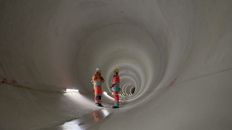
River Thames Tideway project video
Paul visits the construction site of a 'super sewer' in London.
Intensive chicken farming and the River Wye video
Paul looks at how agricultural pollution is affecting the River Wye.